Log in
All resources
Create a design
2,799 Free Artworks of Latin Language
bibliothèque nationale de france
maps by willem and johannes blaeu
latin-language maps
eran laor cartographic collection
guillaume sanson
baroque
joris hoefnagel
willem blaeu
context files from gallica
philippe de la rué
maps of peñón de vélez by braun & hogenberg
maps of tunis by braun & hogenberg
theatrum historium ad annum christi quadringentesinum by guillaume delisle (1705)
1740s maps showing history
maps by alexis-hubert jaillot
sanson maps of the holy land
chodorlahomoris aelamitarum regis et confoederatorum regna ; seu aelamitarum imperium, antiquitati a gulielmo sanson restitutum, magnas repraesentans regiones a mari aegaeo ad indumusque fluvium quibus... - btv1b531793037
guillaume sanson
texts about india
willem blaeu
maps from gallica
old maps of paris
old maps of seville
baroque
maps of peñón de vélez by braun & hogenberg
maps of tunis by braun & hogenberg
maps by willem and johannes blaeu
1663 maps of africa
magni ducatus lithuaniae
radziwiłł (surname)
maps of bordeaux by braun & hogenberg
maps of nîmes by braun & hogenberg
1690s maps of greece
maps from gallica
maps of meldorf by braun & hogenberg
maps of heide by braun & hogenberg
laurens reael
willem blaeu
theatrum historium ad annum christi quadringentesinum by guillaume delisle (1705)
18th-century maps showing history
maps by willem and johannes blaeu
beausse
limousin (province) in the 17th century
context files from gallica
context files from gallica
history of rügen
eran laor cartographic collection
cornelis danckerts (ii)
old maps of toledo, spain
1580s maps of spain
1840s maps of the world
german renaissance
eran laor cartographic collection
alexis-hubert jaillot
eran laor cartographic collection
gerard de jode
eran laor cartographic collection
willem blaeu
eran laor cartographic collection
alexis-hubert jaillot
eran laor cartographic collection
gerard de jode
eran laor cartographic collection
philippe de la rué
johannes honterus
renaissance
maps of meldorf by braun & hogenberg
maps of heide by braun & hogenberg
maps of béthune by braun & hogenberg
bibliothèque nationale de france
arnold van langren map of southwest africa
renaissance
1667 sanson map of africa
1702 maps of africa
china veteribus sinarum regio nunc incolis tame dicta
bibliothèque nationale de france
maps of bourges by braun & hogenberg
maps of orléans by joris hoefnagel
van langren map of southeast asia
1595 maps of asia
16th-century maps of switzerland
ferrando bertelli
map of ancient asia minor by philippe de la rué
bibliothèque nationale de france
maps of provence by pierre-jean de bompar
bibliothèque nationale de france
bibliothèque nationale de france
guillaume sanson
bibliothèque nationale de france
guillaume sanson
maps by willem and johannes blaeu
17th-century maps of xaintonge
maps of liège by baptista van doetecum
maps by abraham ortelius
maps of dordrecht by braun & hogenberg
bibliothèque nationale de france
cartouches by willem and johannes blaeu
bibliothèque nationale de france
bibliothèque nationale de france
carolus allard
maps of ancient italy by philipp clüver
old maps of the alps
maps by willem and johannes blaeu
old maps of capitanata
maps by willem and johannes blaeu
17th-century maps of abruzzo
bibliothèque nationale de france
1667 sanson map of africa
maps of brno by braun & hogenberg
bibliothèque nationale de france
map of the strait of kerch by guillaume sanson
bibliothèque nationale de france
map of ancient asia minor by philippe de la rué
bibliothèque nationale de france
maps of béthune by braun & hogenberg
bibliothèque nationale de france
territorium argentoratense (1652 map)
bibliothèque nationale de france
maps of vienne by braun & hogenberg
maps of lyon by braun & hogenberg
maps by matthäus merian
baroque
arnold van langren map of southwest africa
1596 maps of africa
bibliothèque nationale de france
guillaume sanson
bibliothèque nationale de france
braun/hogenberg dreizehn orte
bibliothèque nationale de france
braun/hogenberg dreizehn orte
china veteribus sinarum regio nunc incolis tame dicta
coats of arms on maps
maps of mons (hainaut) by braun & hogenberg
maps of arras by braun & hogenberg
17th-century maps of the holy roman empire
maps by pieter van der keere
maps of lake geneva by jacques goulart
bibliothèque nationale de france
description of the nobility of hainaut by braun & hogenberg
bibliothèque nationale de france
bibliothèque nationale de france
guillaume sanson
16th-century maps of switzerland
ferrando bertelli
maps of munich by joris hoefnagel
bibliothèque nationale de france
maps by willem and johannes blaeu
old maps of berry
maps of budapest by braun & hogenberg
maps of vienna by braun & hogenberg
maps by johann baptist homann
sanson maps of the holy land
bibliothèque nationale de france
guillaume sanson
mdxii (numeral)
1628 maps
illustrations de histoire naturelle - tome i - de seve 1749
baroque
illustrations de histoire naturelle - tome i - de seve 1749
baroque
17th-century maps of tartary
17th-century maps of siberia
maps by jean-baptiste bourguignon d'anville
old maps of roman hispania
high renaissance
pirro ligorio
16th-century maps of crete
old maps of candia
old maps of nova belgica et anglia nova
maps by willem and johannes blaeu
maps of île-de-france by françois de la guillotière
bibliothèque nationale de france
maps of île-de-france by françois de la guillotière
bibliothèque nationale de france
maps of agnano and grotta del cane by braun & hogenberg
bibliothèque nationale de france
maps of bourges by braun & hogenberg
maps of orléans by joris hoefnagel
maps by willem and johannes blaeu
1640s maps of belgium
maps by willem and johannes blaeu
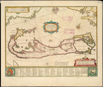
17th-century maps of bermuda
maps by pieter van der keere
17th-century maps of czechia
17th-century maps of nord (department)
maps of artois
maps of ancient italy by philipp clüver
old maps of the history of liguria
old maps of bermuda from the norman b. leventhal map center
1639 maps
eran laor cartographic collection
hendrik hondius the younger
eran laor cartographic collection
hendrik hondius the younger
maps of alsace, breisgau and sundgau by gerardus mercator
maps by willem and johannes blaeu
17th-century maps of the isle of man
maps by willem and johannes blaeu
maps of chomutov by braun & hogenberg
maps of čáslav by braun & hogenberg
1630s maps of the americas
maps by jodocus hondius ii
veteris novae que urbis amstelodamensis ichnographia, continens publica aedificia ; veterem subnigrioribus... delineata auctore d. stalpaert - btv1b53212660h
bibliothèque nationale de france
maps of chomutov by braun & hogenberg
maps of čáslav by braun & hogenberg
china veteribus sinarum regio nunc incolis tame dicta
bibliothèque nationale de france
maps of campi flegrei by braun & hogenberg
bibliothèque nationale de france
2301 - 2400 of 2,799
Next page
/ 28